
At the battle of Little Big Horn a few West Virginians fought valiantly with Gen. George A Custer. Sgt. Benjamin C Criswell received the Medal of Honor for his bravery in that battle. |
The old bank was in the approximate area of the red square, a city block west of Holderby's property. The old B&O RR station was rebuilt as Heraitage Station. The above link displays a page with an old photo of the station at the bottom. |
Colonels 7200 Brigadier Generals 12,500 Chaplains 2200 Surgeons 4800 640 acres = 1 sq. mile |
Parts of our area were parceled out to many of the Revolutionary War Soldiers in Bounty Grants to pay them for enlisting and serving in the Continental Army. The colonies had little money left but some had vast amounts of fertile western lands to grant. The table below shows the grants given in acres by rank of soldiers. |
If you would like to learn more of this early period of our history this site provides a lovely Timeline and more. |
The preception of the area now is that of being a place for pensioners, students, and children. Those in-between these groups are faced with an inevitable relocation if they wish to prosper and prepare for retirement. Some hold onto their jobs and homes hoping to survive to retirement. If one walks around the town and chats with those still living here it will reveal many people in their late forties and early fifties who claim to be retired as their work places closed or furloughed them. Some have a spouse who is still working in order to provide insurance and supplemental income for their livelihood. There are so many who still believe the rest of the world is just like Huntington and there is no sense in leaving. Many believe this area is the least expensive of all to live. It is the hopes of those creating this web site to provide a glimpse of how life could be a couple of hours away. Perhaps this website will enlighten those who feel stranded here without hope or direction. For those who have left and and are now prospering, this may offer a better understanding of the circumstances which made them a refugee from the home of their childhood . (un) employment data. |
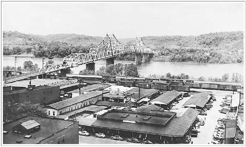
A 1952 view of the old city market in the early downtown of Huntington, WV. Today the Civic Center sits just to the right of this photo and this is a short distance downriver from the Holderbys Landing. The sixth street bridge was the lower end of the original downtown which started near Ninth Street and Third Ave. The buildings were of the Richardson period of architecture where the Fourth Ave buildings are of Sulivan period. The city market was demolished around 1970 and urban renewal took the rest. Although city officials could manage the destruction of the old town area they couldn't provide the rebuilding. The building of the Barboursville Mall in the early eighties doomed the project. |
So how did Huntington, West Virginia come into being? Originally Guyandotte located at the east end of what is now Huntington resided on the banks of the Ohio River. One day a railway magnate named Collis P. Huntington stopped there and was angered by a traffic fine he received for tying his horse in front of a tavern such that it blocked the sidewalk. The severe fine angered and filled him with a resolve against Guyandotte. Mr. Huntington used his influence to bring the C&O railroad several miles downriver to Holderby's Landing and as a result Guyandotte stayed an isolated community separated from Huntington by the Guyan River . It would witness the city of Huntington grow to become the largest city in the state of West Virginia and the terminus between the midwest and James River Bay. This is Huntington"s origin. During the time of its growth it became the banking capital of the billion dollar coal fields deep within southern West Virginia. Many mining companies located headquarters here as did the banks, railroad shops , and river boat companies. Factories soon followed and Marshall Academy was founded. Railroads brought goods to the area and coal to the Ohio River as the Big Sandy and Tug Fork Rivers were not navigable for that purpose. Hutington's growth peaked at over 100,000 people by the early 1950's just 80 years after its founding in 1870. C P Huntington died in 1900. |
drove these people from the choice farmlands that they had cleared and cultivated. They took refuge in the hill and mountain areas. Melungeon descendents are all around us. BBC Article: click here Wired.com Article: click here Big Melungeon Web Site: click here Elvis may have been of Melungeon descent ! |
The "Country Music Highway" State Rt 23 pays tribute to our rich heritage of music. When you listen to the fiddle, banjo, dobro 60, dulcimers, mandolin, and guitars playing there is a distinct Appalachian quality to this country music. "Blue Grass" is the unique voice of the music of this area and musical fesivals abound in this |
Some of the earliest people to live in this region were the "Adena" Indians who may have thrived 3000 years ago. Not much is known about these people as they didn't keep records nor did those who followed. In WV there were "Hopewell" & "Fort Ancient" Indians and in Ohio the last ancient Indians were the "Cole". Most folks know these people as the "Moundbuilders". They built huge earthen mounds in which to bury their dead along with the artifacts of the deceased. The mounds are common in the Ohio and West Virginia area and even into the Mississippi River Valley. MAP. The "Adena" & " Hopewell" peoples were hunter & gatherers while the "Fort Ancient" were cultivators of crops. Little is known of the "Cole Culture" except that they were the last of the ancient indians. Some of these ancient Indians thrived in large communities before Rome, Italy was even a small village. Ironton Lake Vesuvius story, "Adena & Hopewell Culture links" Portsmouth, Ohio is the next big town down the river from Ironton, Ohio. In this area there is a most unique Indian mound which is created in the form of a serpent. "The Serpent Mound" is quite large, and a smaller one is constructed next to it. For many years it was not known what the meaning of it was. Today it is an Ohio State Park. Scientist have advanced the notion that it was a way of predicting the solstice and equinox to determine the seasons, similar to "Stonehenge" in the UK. The Serpent Mound. 1 2 3 |
Ironton, Ohio was the riverport of one of the earliest Iron centers in the States. Highgrade Pig Iron which resisted rust and corosion was made here. Many forms of products were created during the years it was producing. Some of the most notable Iron work that is seen on Bourbon Street in New Orleans, La was created here and shipped via river to that destination. Cannon barrels were produced during the Civil War as well. Machine parts for riverboats and farm implements were made locally also. The regions around Ironton were rich with iron ore, limestone, and timber to create charcoal to fire these huge stone furnaces. Horses and Oxen would be used to pull wagons loaded with iron pigs for shipping to the river port at Ironton. In the later years of the pig iron phase the worlds first and only woman "Iron Master" Mrs. Nanny Kelly Wright took over the business after her husband's death. For a while she was the world's wealthiest woman. Her old stone home still stands and is occupied. Walking tours are given during the nicer months of the year where you can see these old restored homes of bygone times. The homes were built by those of the Iron business, and the riverboat industry which predated the railroads by decades. About 40 miles downriver from Ironton is Portsmouth, Ohio which was the southern terminus of Ohio's Erie Canal. The northern end was in Cleveland, Ohio. It joined the New York Erie Canal thru Lake Erie and Lake Ontario. Heavy floods brought an end to the Portsmouth end of the canal by 1925. The Erie Canal predated the railroads by nearly 25 years. |
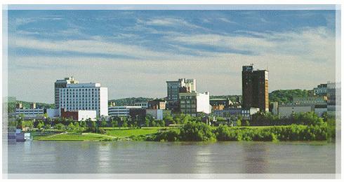
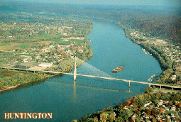
Up river about 16 miles from the Big Sandy River is the Guyan River, which is another tributary to the Ohio River. If you look at the photo of the bridge to the right, at the lower right side where the trees and houses are, this is the banks of the Guyan River. Just upstream of the bridge to the right is Guyandotte, the origins of the city of Huntington, WV. Photo to the left is river front Huntington, "The Jewel City". Marshall University is here and the primary industry of this town as it is said to put $80,000,000 dollars into the local economy annually. The University is known for it's teachers college east of the Mississippi. A sleepy little town that is so laid back, if it were anymore laidback it would be in a coma. To the left of the bridge is Proctorville, Ohio. It is called the bedroom of Huntington as so many have moved from the town to make their residence here. It is much less expensive, being a resident of Ohio. So, every person comes from somewhere in the world....and this is my somewhere. The "UGRR" white box in the bridge photo (above left), if you will notice, is a historic Underground Rail Road point where Negro slaves were brought to their freedom in Ohio. There are old houses in the area where they were hidden within the basements. On the walls the escaping slaves carved symbols to guide those later fleeing from slavery. Thus a hint of who had passed thru in their trek north to be free. The Ohio River was about half as wide back then and much more shallow and prone to freeze over in winter. If you are familiar with the book "Uncle Tom's Cabin" , I believe there is a description of a slave mother "Liza", carrying her baby as she fled accross the river by jumping from one ice floe to another in the darkness of night while being pursued by bounty hunters. Can you imagine the drama? Before the Civil War "The Missouri Compromise of 1820" & "The Fugitive Slave Law of 1850" were some measures to keep the union intact, but it was a tyranny that made the UGRR risky for everyone. These laws were born from the efforts of a Kentucky Senator, "Henry Clay" (the great compromiser), Sen. Daniel Webster, Mass. ("Union now and forever") and Sen. John C. Calhoun, S. Carolina. (Strong States Rights & slave advocate of the South) Called the "triumvirate" these men held the fragile Union together until 1861. West Virginia was signed into statehood the same day Lincoln gave the Gettysburg Address toward the end of the Civil War, and it was the only state created as a result of the Civil War. The Ohio side (left) is Rome Township where the "Rome Beauty Apple" was developed. Most of the area in the photo was Apple Orchard when the slaves escaped during the Underground Railroad days. They found cover and safety until they could be hidden and instructed on the safe trails north to freedom. As you can see the area has many different meanings for people who pass thru and learn about us. |
A little about the area of the USA that I live in......The Ohio Valley: The First American West |
So, this is what the Ohio Valley looks like during the spring time of the year. It is not uncommon to see 95 degree temps with 90+ humidity in the summer months. The winters are cold but rarely below 10 degrees although we have seen - 20 degrees on occasions. The river seldom freezes over in the winter and ice fishing isn't common here. This area developed after the Revolutionary War as land grants were given to the soldiers who fought in the Revolutionary War. The British protected the colonies before the war and did not want settlers traveling west of the Allegheny Mountains as they would have the expense of protecting them from indians. So the colonist were confined for several reasons. The founding fathers did not want it developed before the war either as they felt the British would see a greater prize in the colonies to fight for. This area was once considered for a 14 th colony to be called Westsylvania. Tennessee was also considered and it was to be called Franklin. Those ideas were discarded because some of our early statesmen didn't want to develop the area and scatter a group of fighting men if a war came, and the Colonial Governor of Virginia who was appointed by the King of England did not want his territory reduced in size. He extracted great wealth from the natural resources of this area which led to dissent from those who lived here. It is a trend to this day to extract wealth from this area without reinvesting in it. Our region probably has the greatest abundance of natural resources of the east coast states, and yet is known as the poorest. There is presently an outmigration of people here to the southern states where they find better paying jobs in those economies. WV is the the fifth highest taxed state, and second to the poorest. The Southern part of Ohio and Eastern part of Kentucky seem to be an extension of West Virginia although it is less expensive to live in Ohio and most who have lived in Ky, and WV feel that they are better off financially living in Ohio. Most visitors love the scenic beauty of these areas and are amazed by political leadership and our economic plight. |
">

">
">
">
Southpoint, Ohio just across the Ohio River. It is the Southernmost point of Ohio just east of Ironton. The smaller river to the left is the Big Sandy River and it defines the boundary between West Virginia and Kentucky. These photos are taken from Virginia Point. |
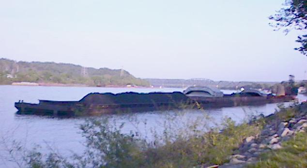
Looking around the other direction toward the city of Huntington, West Virginia. The barge in front is loaded with coal and those behind are freighters with their fiberglass covers stacked. This is the Ohio River Valley area where the three states merge. |
So, this is what the Ohio Valley looks like during the spring time of the year. It is not uncommon to see 95 degree temps with 90+ humidity in the summer months. The winters are cold but rarely below 10 degrees although we have seen - 20 degrees on occasions. The river seldom freezes over in the winter and ice fishing isn't common here. This area developed after the Revolutionary War as land grants were given to the soldiers who fought in the Revolutionary War. The British protected the colonies before the war and did not want settlers traveling west of the Allegheny Mountains as they would have the expense of protecting them from indians. So the colonist were confined for several reasons. The founding fathers did not want it developed before the war either as they felt the British would see a greater prize in the colonies to fight for. This area was once considered for a 14 th colony to be called Westsylvania. Tennessee was also considered and it was to be called Franklin. Those ideas were discarded because some of our early statesmen didn't want to develop the area and scatter a group of fighting men if a war came, and the Colonial Governor of Virginia who was appointed by the King of England did not want his territory reduced in size. He extracted great wealth from the natural resources of this area which led to dissent from those who lived here. It is a trend to this day to extract wealth from this area without reinvesting in it. Our region probably has the greatest abundance of natural resources of the east coast states, and yet is known as the poorest. There is presently an outmigration of people here to the southern states where they find better paying jobs in those economies. WV is the the fifth highest taxed state, and second to the poorest. The Southern part of Ohio and Eastern part of Kentucky seem to be an extension of West Virginia although it is less expensive to live in Ohio and most who have lived in Ky, and WV feel that they are better off financially living in Ohio. Most visitors love the scenic beauty of these areas and are amazed by political leadership and our economic plight. |
A little about the area of the USA that I live in......The Ohio Valley: The First American West |
email d_jsaan@hotmail.com |

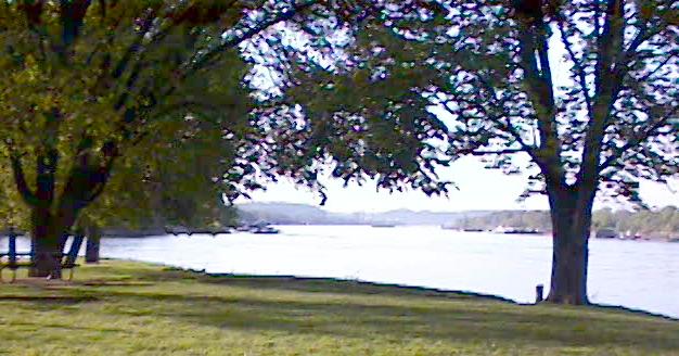
The Ohio River is still a major waterway with various ships such as The Delta Queen taking sightseers from Pittsburgh, PA. to the Mississipi River and modern tow boats moving parts to coal burning power generating plants which are located along the Ohio River Valley. Small cruise ships which look like "The Love Boat" of television fame, pass thru here to the drydocks for repairs. Many barge tows filled with coal, chemicals, and machinery travel these waters as well. Most of this is just passing by the area. |
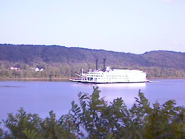
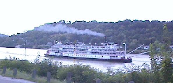
The American Queen is a replica of earlier sternwheelers to ply the great rivers. Built in recent times it is a beautiful gift to the rivers and those who wish to squint their eyes can imagine themselves in earlier times such as Mark Twain saw as a kid in Hannibal, Mo. |
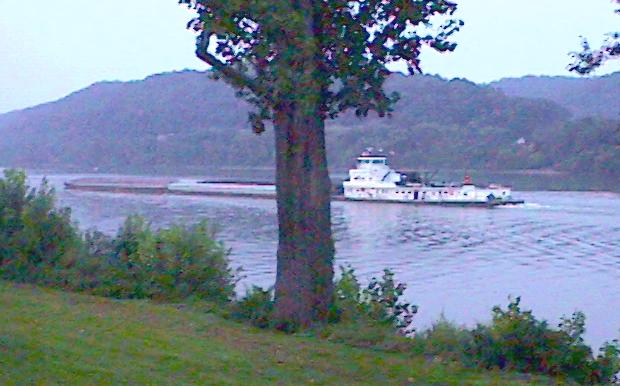
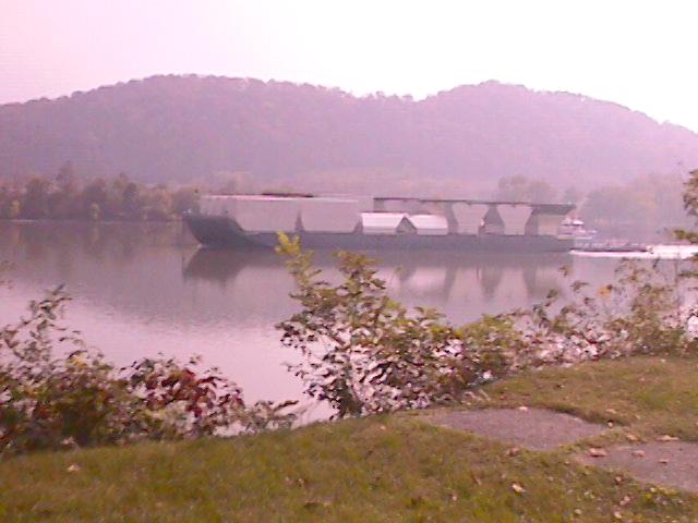
A modern tow boat pushing barges full of freight upriver. These use two V-16 Diesel engines which are turbocharged to produce about 3000 horsepower delivered to two prop. Crews include Captain, Steermen, Engineers, Deckhands, & Cooks, who work 30 day shifts. |
">
">
">
">
">
">
">
">
UGRR |
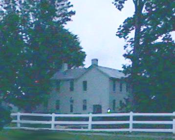
Here is an example of a home which was used by the Underground RailRoad in those times. |
The cellars were made of handhewn stone laid like blocks. Homes and Barns here were built in this way. |
Up river about 16 miles from the Big Sandy River is the Guyan River, which is another tributary to the Ohio River. If you look at the photo of the bridge to the right, at the lower right side where the trees and houses are, this is the banks of the Guyan River. Just upstream of the bridge to the right is Guyandotte, the origins of the city of Huntington, WV. Photo to the left is river front Huntington, "The Jewel City". Marshall University is here and the primary industry of this town as it is said to put $80,000,000 dollars into the local economy annually. The University is known for it's teachers college east of the Mississippi. A sleepy little town that is so laid back, if it were anymore laidback it would be in a coma. To the left of the bridge is Proctorville, Ohio. It is called the bedroom of Huntington as so many have moved from the town to make their residence here. It is much less expensive, being a resident of Ohio. So, every person comes from somewhere in the world....and this is my somewhere. The "UGRR" white box in the bridge photo (above left), if you will notice, is a historic Underground Rail Road point where Negro slaves were brought to their freedom in Ohio. There are old houses in the area where they were hidden within the basements. On the walls the escaping slaves carved symbols to guide those later fleeing from slavery. Thus a hint of who had passed thru in their trek north to be free. The Ohio River was about half as wide back then and much more shallow and prone to freeze over in winter. If you are familiar with the book "Uncle Tom's Cabin" , I believe there is a description of a slave mother "Liza", carrying her baby as she fled accross the river by jumping from one ice floe to another in the darkness of night while being pursued by bounty hunters. Can you imagine the drama? Before the Civil War "The Missouri Compromise of 1820" & "The Fugitive Slave Law of 1850" were some measures to keep the union intact, but it was a tyranny that made the UGRR risky for everyone. These laws were born from the efforts of a Kentucky Senator, "Henry Clay" (the great compromiser), Sen. Daniel Webster, Mass. ("Union now and forever") and Sen. John C. Calhoun, S. Carolina. (Strong States Rights & slave advocate of the South) Called the "triumvirate" these men held the fragile Union together until 1861. West Virginia was signed into statehood the same day Lincoln gave the Gettysburg Address toward the end of the Civil War, and it was the only state created as a result of the Civil War. The Ohio side (left) is Rome Township where the "Rome Beauty Apple" was developed. Most of the area in the photo was Apple Orchard when the slaves escaped during the Underground Railroad days. They found cover and safety until they could be hidden and instructed on the safe trails north to freedom. As you can see the area has many different meanings for people who pass thru and learn about us. |
Ironton, Ohio was the riverport of one of the earliest Iron centers in the States. Highgrade Pig Iron which resisted rust and corosion was made here. Many forms of products were created during the years it was producing. Some of the most notable Iron work that is seen on Bourbon Street in New Orleans, La was created here and shipped via river to that destination. Cannon barrels were produced during the Civil War as well. Machine parts for riverboats and farm implements were made locally also. The regions around Ironton were rich with iron ore, limestone, and timber to create charcoal to fire these huge stone furnaces. Horses and Oxen would be used to pull wagons loaded with iron pigs for shipping to the river port at Ironton. In the later years of the pig iron phase the worlds first and only woman "Iron Master" Mrs. Nanny Kelly Wright took over the business after her husband's death. For a while she was the world's wealthiest woman. Her old stone home still stands and is occupied. Walking tours are given during the nicer months of the year where you can see these old restored homes of bygone times. The homes were built by those of the Iron business, and the riverboat industry which predated the railroads by decades. About 40 miles downriver from Ironton is Portsmouth, Ohio which was the southern terminus of Ohio's Erie Canal. The northern end was in Cleveland, Ohio. It joined the New York Erie Canal thru Lake Erie and Lake Ontario. Heavy floods brought an end to the Portsmouth end of the canal by 1925. The Erie Canal predated the railroads by nearly 25 years. |
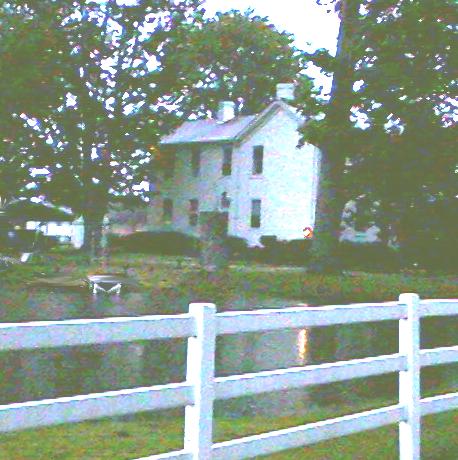
Petroglyphic symbols were made by the slaves on the stone walls of the cellars of homes like this one. The example used at the left is just to give an idea of what someones symbol could have looked like. Symbols could mark a trail, communicate, and provide reassurance. |
Some of the earliest people to live in this region were the "Adena" Indians who may have thrived 3000 years ago. Not much is known about these people as they didn't keep records nor did those who followed. In WV there were "Hopewell" & "Fort Ancient" Indians and in Ohio the last ancient Indians were the "Cole". Most folks know these people as the "Moundbuilders". They built huge earthen mounds in which to bury their dead along with the artifacts of the deceased. The mounds are common in the Ohio and West Virginia area and even into the Mississippi River Valley. MAP. The "Adena" & " Hopewell" peoples were hunter & gatherers while the "Fort Ancient" were cultivators of crops. Little is known of the "Cole Culture" except that they were the last of the ancient indians. Some of these ancient Indians thrived in large communities before Rome, Italy was even a small village. Ironton Lake Vesuvius story, "Adena & Hopewell Culture links" Portsmouth, Ohio is the next big town down the river from Ironton, Ohio. In this area there is a most unique Indian mound which is created in the form of a serpent. "The Serpent Mound" is quite large, and a smaller one is constructed next to it. For many years it was not known what the meaning of it was. Today it is an Ohio State Park. Scientist have advanced the notion that it was a way of predicting the solstice and equinox to determine the seasons, similar to "Stonehenge" in the UK. The Serpent Mound. 1 2 3 |
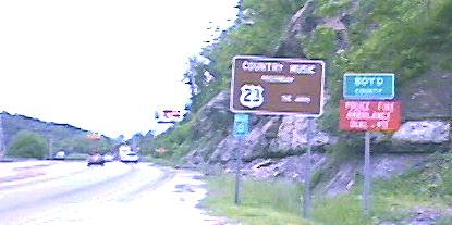
The "Country Music Highway" State Rt 23 pays tribute to our rich heritage of music. When you listen to the fiddle, banjo, dobro 60, dulcimers, mandolin, and guitars playing there is a distinct Appalachian quality to this country music. "Blue Grass" is the unique voice of the music of this area and musical fesivals abound in this |
Guyandotte |
Proctorville |
Huntington |
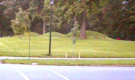
These three mounds in Ashland, Ky Central Park are part of a group which are said to be worn down to a fraction of their original size. They may have been created over 2000 years earlier. They could have been built by any of these groups of ancient people. |
Near Portsmouth, Ohio is the town of Peebles. The Serpent Mound State Park is in excellent condition for the guest of the park to view. This artifact is completely unique and questions as to whether the mound building indians were the true builders have been ask. |
Have you wondered about moving away to get a good job ?? A few hours away ! |
">
">
">
">
The Lost People of Appalachia, the Melungeons |
Some of the earliest settlers of the Appalachian area were not northern Europeans, but possibly of Turkish descent. They were brought here by the Portugese settlers and also by Sir Francis Drake who liberated them from the Spanish. These people thru the years intermingled with Blacks and Native Americans and began farming in the region. Later the Europeans |
drove these people from the choice farmlands that they had cleared and cultivated. They took refuge in the hill and mountain areas. Melungeon descendents are all around us. BBC Article: click here Wired.com Article: click here Big Melungeon Web Site: click here Elvis may have been of Melungeon descent ! |
So what of the real history of this region? How did this area begin and when? What were the factors that led to the tri state area building up to what it became? Why are we as we are now, when just fifty years ago we were 100,000 strong and being "The Jewel City" meant something? Reviewing our country's history from just after the Revolutionary War until WW11 offers many answers. To some people this story is just a moot point as the region could never return to its former stature in their lifetimes, but it is worth offering some explainations to those who are curious By just moving a few states away, however, anyone living here today can prosper in a manner as their forefathers did a few years ago. |
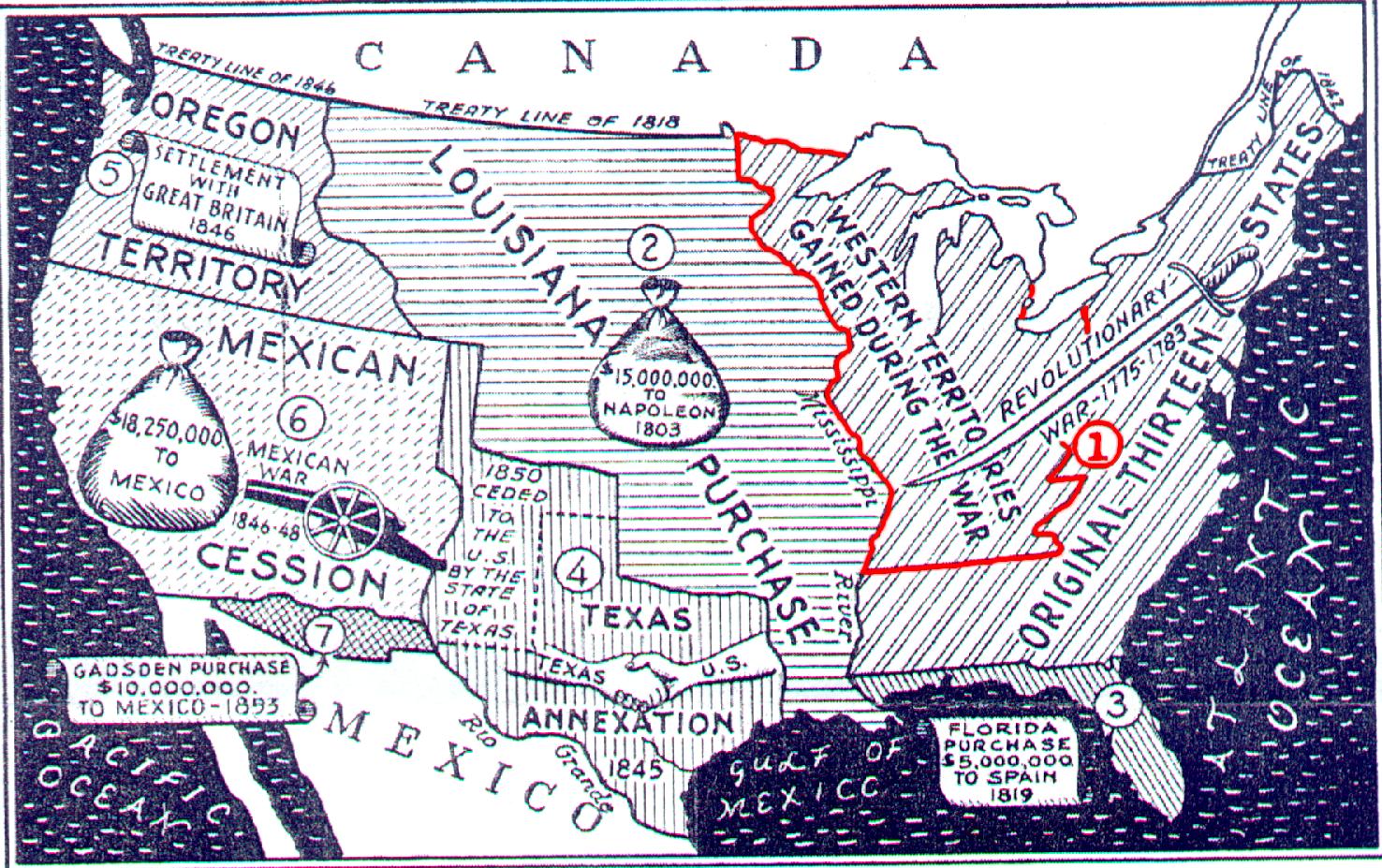
Map of America's Developent |
">
">
">
">
Our area outlined in red is "The First American West" and began at the end of the Revolutionary War. You will notice the gold star on the saber is the approximate location of our tristate area on the Ohio River. This was a conduit from the Colony/States to move west into the Louisiana Purchase lands or into the territory of Texas. Revolutionary war soldiers were granted tracts of land in our region and found it abundant with natural resources. We began to populate and develop farms, transportation routes, and frontier industries. After this time the Louisiana Purchase was made and canal building in New York state soon followed this westward expansion. In the forty yeas following the War of 1812 our nation experienced the greatest period of growth in its history and the Ohio Valley was central to it. The topography made the Ohio River the main avenue between the Atlantic coast and the Mississippi valley in that it was the only navigable westward flowing river in eastern North America. Canals were constructed across Ohio, Indiana, and Illinois following those built in New York, and Pennsylvania. In the 1830's Ohio's Erie and Miami canals connected Lake Erie to the Ohio River, making it possible for people to travel from New York City to New Orleans in thirty days. The most important technological innovation of this time were the steamboats of lake Ontario and Erie and the Ohio and Mississippi Rivers. Steamboat commerce on the Ohio River grew rapidly between 1811 to 1830 and the profits soared. By 1850 railroads were being constructed here and every Ohio River port had a railroad connection such that freight shipped on the river could be transferred to railcars and moved further inland. The early 1800's laid the foundation for the industrial development for the upper Ohio Valley due to the abundance of iron ore, salt, and coal. This region was becoming more accessible to skilled European people who brought their dreams, abilities, sense of industry, and families to live here. The labor pool was provided by the offspring of the pioneer farm families. These frontier hardened workers yielded the manpower for the industries, commerce, and transportation systems which created the strong economy that we realized by the end of WW11. |
So how did Huntington, West Virginia come into being? Originally Guyandotte located at the east end of what is now Huntington resided on the banks of the Ohio River. One day a railway magnate named Collis P. Huntington stopped there and was angered by a traffic fine he received for tying his horse in front of a tavern such that it blocked the sidewalk. The severe fine angered and filled him with a resolve against Guyandotte. Mr. Huntington used his influence to bring the C&O railroad several miles downriver to Holderby's Landing and as a result Guyandotte stayed an isolated community separated from Huntington by the Guyan River . It would witness the city of Huntington grow to become the largest city in the state of West Virginia and the terminus between the midwest and James River Bay. This is Huntington"s origin. During the time of its growth it became the banking capital of the billion dollar coal fields deep within southern West Virginia. Many mining companies located headquarters here as did the banks, railroad shops , and river boat companies. Factories soon followed and Marshall Academy was founded. Railroads brought goods to the area and coal to the Ohio River as the Big Sandy and Tug Fork Rivers were not navigable for that purpose. Hutington's growth peaked at over 100,000 people by the early 1950's just 80 years after its founding in 1870. C P Huntington died in 1900. |
There were many unfortunate decisions which altered the course of Huntington's future at this time. The first being the shift to automation in the coalfields in the early fifties. The workforce was cut and many miners and laborers left the state. For each of those laid off there were jobs in support industries which were lost as well. Mining is more profitable and efficient for out-of-state owners and investers, but causes this area to suffer economically. A government backed movement for industry to change from coal to oil fuel took place then. Chemical industries producing a basic chemical called Urea, chose natural gas over coal for their raw material. In the late fifties the decision was made to take the banking of the coal fields to Pittsburgh, Pa as they were thought to have a better banking system with more to offer those in the coal business. Unionization had led to investors and owners fears that the banks may join with unions also. This was perhaps the single most important reason for the slow decline of Huntington and the region to the economic wasteland it is today. The primary source of money coming to the town and area left never to return. Those factories, shops, public works, government offices, and college could not collectively keep the town operating as it had with the absence of the coal fields assets. Within ten years the town and adjoining communities were noticing the impact as people were being laid off when shops closed or left the area. Many of the best leadership people left the area then realizing what would ultimately be the fate of the town. Those who followed were not elected so much for their ability to govern or lead, but their popularity. Most of their fiscal policies have been failures. In the sixties Huntington was offered help by the federal government by locating agencies here and the leaders declined it. Charleston, WV the state capital was more than eager to have them located there. There had always been bickering between the two cities since Charleston out grew Huntington. This led to Huntington receiving little or no help from the state's capital and Charleston began to appear as Rome did in Italy. A city state. Huntington needed bridges and advanced roads which would help the flow of commerce yet the decision was made to locate I-64 far south of the town. Further there was little in the way of an express way to link the downtown of Huntington to this new interstate highway so businesses weren't too eager to locate new facilities here. Charleston received the new bridges and road improvements until the late sixties. |
">
">
">
">
A 1952 view of the old city market in the early downtown of Huntington, WV. Today the Civic Center sits just to the right of this photo and this is a short distance downriver from the Holderbys Landing. The sixth street bridge was the lower end of the original downtown which started near Ninth Street and Third Ave. The buildings were of the Richardson period of architecture where the Fourth Ave buildings are of Sulivan period. The city market was demolished around 1970 and urban renewal took the rest. Although city officials could manage the destruction of the old town area they couldn't provide the rebuilding. The building of the Barboursville Mall in the early eighties doomed the project. |
By the mid seventies a Mall was being built at Ona, West Virgina a few miles east of Huntington and located by the interstate. This was the kiss of death for the downtown businesses of Huntington, and urban renewal saw the destruction of the old early downtown area north of Third Avenue. Today it is called the superblock parking lot. Nearly half of the downtown of Huntington was torn down then and the leaders could not generate the ways and means to rebuild it. In this time an outmigration of people has left the town with half of it's original population base. Those left here must absorb the same tax burden while fearing the loss of their jobs . The companies which provided good wages are almost extinct now, so workers find themselves holding multiple jobs and long hours in order to meet their living expenses. Each spring more people resolve to leave while the weather will allow them to afford the move. Living outside the city is the choice of most middle class. |
The preception of the area now is that of being a place for pensioners, students, and children. Those in-between these groups are faced with an inevitable relocation if they wish to prosper and prepare for retirement. Some hold onto their jobs and homes hoping to survive to retirement. If one walks around the town and chats with those still living here it will reveal many people in their late forties and early fifties who claim to be retired as their work places closed or furloughed them. Some have a spouse who is still working in order to provide insurance and supplemental income for their livelihood. There are so many who still believe the rest of the world is just like Huntington and there is no sense in leaving. Many believe this area is the least expensive of all to live. It is the hopes of those creating this web site to provide a glimpse of how life could be a couple of hours away. Perhaps this website will enlighten those who feel stranded here without hope or direction. For those who have left and and are now prospering, this may offer a better understanding of the circumstances which made them a refugee from the home of their childhood . (un) employment data. |
The Revolutionary War period history of this area is not common knowledge to many here today. Most are shocked to hear that the first battle of that war occurred in Point Pleasant, West Virginian. Ironically many suggest that "The Battle Of Blue Licks", southwest of Maysville, Kentucky, could have been the last battle of the Revolution in that it was fought ten months after the battle at Yorktown, Virginia which was the last major battle of the Revolutionary War. |
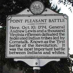
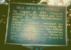
"On August 19, 1782, Pioneers suffered a bitter defeat and were routed by their Revolutionary War enemies. Captain Caldwell concealed his British and Indian army along the ravines leading from this hilltop to the Licking River. Advancing into this ambush, the Pioneers were outnumbered and forced to flee across the river." |
If you would like to learn more of this early period of our history this site provides a lovely Timeline and more. |
Parts of our area were parceled out to many of the Revolutionary War Soldiers in Bounty Grants to pay them for enlisting and serving in the Continental Army. The colonies had little money left but some had vast amounts of fertile western lands to grant. The table below shows the grants given in acres by rank of soldiers. |
Private 640 Non-Coms 1000 Captains 3840 Majors 4000 Lt. Colonels 2760 Lt Colonels commandants 7200 |
Colonels 7200 Brigadier Generals 12,500 Chaplains 2200 Surgeons 4800 640 acres = 1 sq. mile |
As you can see a Private would have been a wealthy man in his own times. Officers may have been able to retire or live as wealthy farmers using, sharecroppers, indentured servants, or slaves to work their lands. Delaware, Vermont, New Jersey, New Hampshire, and Rhode Island did not have land to grant the soldiers. |
If you talk with former residents who live away from here, you may hear them speak of retiring and moving back to the area. Certainly they will have pensions and resources to come back and live comfortably in their later years. This is about the best the area could expect with its present circumstances. The opportunities to reverse the economic trends that are with us today were lost as a result of decisions made in the fifties and sixties. For the young people of this area there is little choice except to leave. It is unlikely that they would ever witness the region return to the economic prosperity known here during the fifties. The question as to why remain in the Huntington tri-state area is one of basic economic thinking that any teen ager can calculate. If the boys want to work and be prosperous they will need to leave, and if the girls want to marry a young man who can provide for his wife and family, then her most logical choice would be to relocate with him. Should you find a good paying job here it's only a matter of time before you are unemployed again. |
Let us encourage you to view the next page of this site by clicking on the link in the bottom right corner. If you are still living in the tri-state area this information was gathered especially for your benefit. Any relocated viewers wishing to contribute photos from their area (which show wages being paid by businesses there) may contact the addresses below. |
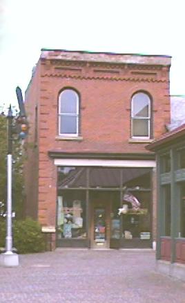
Heritage Station is the new location of the old Huntington Bank building which was the towns first Bank. It was moved from Third Ave & Fifteenth Street in the mid seventies HS project. Jesse James and his gang are said to have robbed it once when it was in business and escaped into Kentucky. Wouldn't this include Huntington as part of the Old West? |
The perception of this area is vague to most peoples minds as it isn't associated with the American Revolution, the Old West, or the Civil War. Even Abraham Lincoln who was born in Kentucky, gets claimed by Illinois as they call themselves "The Land of Lincoln". Writers of western stories have led us to believe St. Louis or St. Joseph, Missouri were really where Americas old west started. It may be because the wagon trains started their expeditions from these locations that we perceive the west as being further away from our Mid Atlantic region. When one thinks of the seaboard states, east of this area, the image of the New England states which are far to the northeast comes to mind. Southern states are clearly defined by the "The War for Southern Independence". It leaves our area isolated without a strong dynamic identity, other than the negative identity created for us by our politicians who dub it "Appalachia" after the eastern mountain range. We just aren't northern, southern, eastern, or western. What then should we call ourselves to reflect a distinct positive image? |
As a last thought to this page, the story of Collis P. Huntington's decision to locate near Holderby's Landing traces to an unscrupulous political leader in Guyandotte. No doubt Mr. Huntington realized that he would be better off creating his own town in a wilderness where he could officiate rather than pay off an existing group of petty crooks who would use their office to extort his enterprise. Large corporations have examined our area for years and then chosen not to locate here. Could they be seeing in Huntington, what Collis P. saw in Guyandotte over 130 years ago? Anyone who remembers their science classes from school days may recall the discussion of parasites. Mistletoe in trees and fleas on dogs are two examples. Our teachers taught us, "A good parasite does not destroy its host". People from our area are prized by employers in other states so why not in our region? Maybe it really isn't the fault of the workers who live in this area at all? When these same West Virginians work in other states they are away from our paracitic band of crooked leaders, corrupt unions, and business groups which work to exclude their competition. Most of these same workers succeed and prosper as did Collis P when they relocate. |
">
">
">
">
The old bank was in the approximate area of the red square, a city block west of Holderby's property. The old B&O RR station was rebuilt as Heraitage Station. The above link displays a page with an old photo of the station at the bottom. |
At the battle of Little Big Horn a few West Virginians fought valiantly with Gen. George A Custer. Sgt. Benjamin C Criswell received the Medal of Honor for his bravery in that battle. |

">
">
">
">
Today the Tri-state area is about 600 miles or a day's drive from 60% of the United States Population, 80% of the US Corporate head quarters offices, and 61% of the US manufacturing facilities. With as little as there is left of what once was here, it is little surprize to see the area's population moving a short distance away to other states and financial prosperity. |
An eTabloid |


This page was last updated on: January 13, 2006
This web site is 100% FREE |
as a gift to its viewers |